Home › Products › Level Instruments › Radar Level Sensors › Radar Water Level Sensor
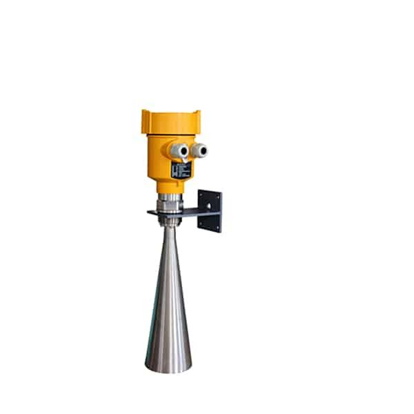
Radar Water Level Sensor (SIRD-908)
A 26 GHz non-contact radar for rivers, lakes, reservoirs and shallows. Mounted on a bracket from a bridge or bank, it reads the water surface to plus or minus 3 mm over 30 m, in rain, fog and sun, with nothing in the water to foul or be swept away.
- Service: rivers, lakes, reservoirs, canals and shallows
- Range / frequency: to 30 m; 26 GHz
- Accuracy: plus or minus 3 mm
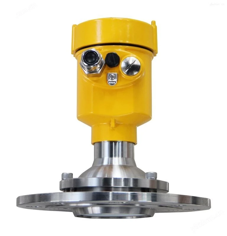
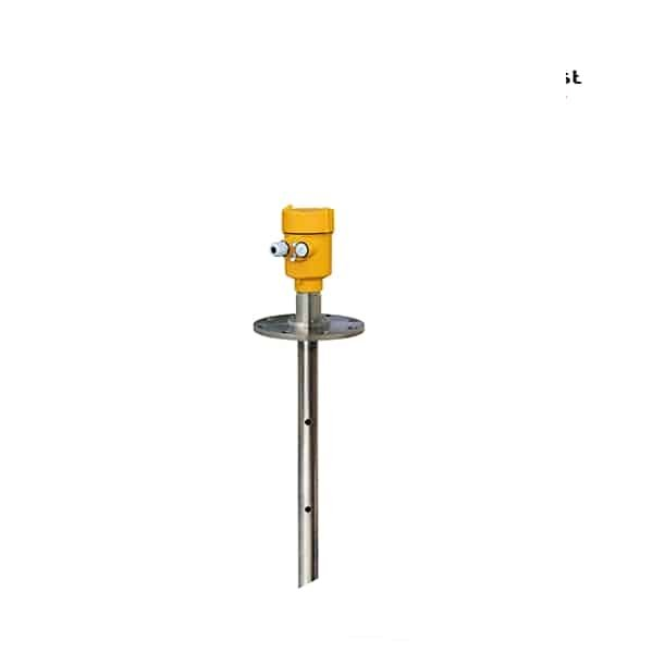
- Mounting: bracket, G1.5 thread or flange; IP67
- Output: 4-20 mA / HART / RS485; low-power DC
Overview
A radar water level sensor measures the level of rivers, reservoirs and open water without touching it. Mounted on a bracket above the surface, it times a 26 GHz pulse to the water and back, so floating debris, silt and current do not affect it and there is no sensor in the flow to be fouled or carried away. It reads to plus or minus 3 mm over a 30 m range.
Because it is non-contact and sealed to IP67, it stands up to rain, fog, sun and wide temperature swings, and it runs on low-power DC so it suits a solar or battery station. With 4-20 mA, HART and RS485 it feeds a data logger, telemetry unit or SCADA, which makes it a practical instrument for hydrology, flood warning and water-resource monitoring.
Features
Why a 26 GHz radar suits open water:
Non-contact
Nothing sits in the water, so debris, silt and current cannot foul or sweep the sensor away.
Weatherproof IP67
Sealed against rain, fog and wash, and rated from −40 to 100 °C for outdoor stations.
Low-power DC
Runs on 6 to 24 V DC, so it pairs with a solar panel or battery at a remote station.
Precise to 3 mm
A 26 GHz beam and plus or minus 3 mm accuracy over 30 m for hydrology and flood data.
Bracket mount
A bracket, G1.5 thread or flange fixes it to a bridge, gantry or bank over the water.
4-20 mA / HART / RS485
Feeds a logger, telemetry unit or SCADA, with Modbus over RS485 for remote sites.
Working principle
The sensor sends a 26 GHz pulse straight down at the water and times the echo from the surface; the water level is the reference height minus the measured distance. Water is a strong reflector, so the echo is clear, and the high frequency makes a narrow beam that aims into a channel or between bridge piers without catching the banks. A reference height set at install ties the reading to a gauge datum.
Because the measurement is non-contact, current, floating debris and silt do not touch the sensor, and there is nothing in the flow to be damaged in a flood. Echo software ignores fixed reflectors such as a pier or a railing and tracks the moving surface, and the sealed IP67 housing keeps rain and spray out of the electronics.
Technical specifications
| Parameter | Specification |
|---|---|
| Model | SIRD-908 radar water level sensor |
| Application | Rivers, lakes, reservoirs, canals and shallows |
| Measuring range | 30 m |
| Frequency | 26 GHz |
| Accuracy | Plus or minus 3 mm |
| Process temperature | −40 to 100 °C; atmospheric pressure |
| Output / display | 4-20 mA / HART (two-wire); RS485 Modbus; four-digit LCD |
| Power supply | DC 6 to 24 V; four-wire DC 24 V option |
| Protection | IP67 / IP65; explosion-proof optional |
| Mounting / housing | Bracket, G1.5 thread or flange; aluminum, plastic or stainless housing |
Selecting a water level radar
For open water the mount and the seal matter as much as the radar. A bracket that holds the sensor over the channel from a bridge or gantry, an IP67 housing and low-power DC make a station that runs on solar in the field. The 26 GHz SIRD-908 reaches 30 m and aims a tight beam into a channel; for a very wide reservoir an 80 GHz radar narrows the beam further. Where the water is hidden under heavy reeds or the bank is the only mount, a submerged hydrostatic sensor may be more practical, and we will say so.
Installation
Fix the sensor on a bracket or gantry so the antenna looks straight down at the water, clear of piers, railings and reeds, and above the highest expected flood level by at least the blanking distance. Set the reference height to the gauge datum so the reading matches the staff gauge. Map fixed reflectors such as a pier with the echo software, and route the cable and the solar or battery supply into the sealed housing through the gland.
Applications
- River and stream stage for hydrology and flood warning
- Reservoir, dam and lake level monitoring
- Irrigation canals, weirs and open channels
- Stormwater and drainage level at pump stations
- Solar telemetry stations feeding SCADA over RS485
Challenge: A water authority needed continuous river and reservoir level for flood and resource monitoring, where a float or contact sensor was fouled by debris and silt.
Solution: Non-contact radar water level sensors on brackets over the channel, set to the gauge datum and feeding the telemetry units that report to the control room.
Result: Continuous, non-contact level through high and low water, with nothing in the flow to be fouled or swept away.
Related products
 Radar Level Transmitter
26 GHz non-contact radar for general liquids, water and storage tanks.
 Radar for Slurry
6 GHz horn radar (SIRD-805) for slurry, viscous and low-dielectric liquids.
Browse all radar level sensors →
FAQ
How does a radar water level sensor work?
It sends a microwave pulse straight down at the water and times the echo back; the water level is a reference height minus the measured distance. Water reflects the 26 GHz pulse strongly, so the echo is clear, and the measurement is non-contact.
Can radar measure river and reservoir level?
Yes. Mounted on a bracket over the channel, the SIRD-908 reads river, reservoir and canal level to plus or minus 3 mm over 30 m, in rain, fog and sun. It runs on low-power DC for a solar station and feeds a logger or SCADA over 4-20 mA, HART or RS485.
How accurate is a radar water level sensor?
The SIRD-908 holds plus or minus 3 mm over its 30 m range. Setting the reference height to the gauge datum at install ties the reading to the staff gauge, and a clear line of sight to the water keeps the echo strong.
What are the disadvantages of radar level sensors?
A surface hidden under heavy reeds, strong fixed reflectors close to the beam, or a mount that cannot see the water can weaken the echo. Choosing the bracket position carefully and using the echo mapping handle most cases; where they cannot, a hydrostatic sensor is the better choice.
Request a quote
Tell us the span from the mount to the lowest water, the channel width, the mounting point and the output and power you have, and we configure one radar for the site, not a shelf part.